click image to view enlargement
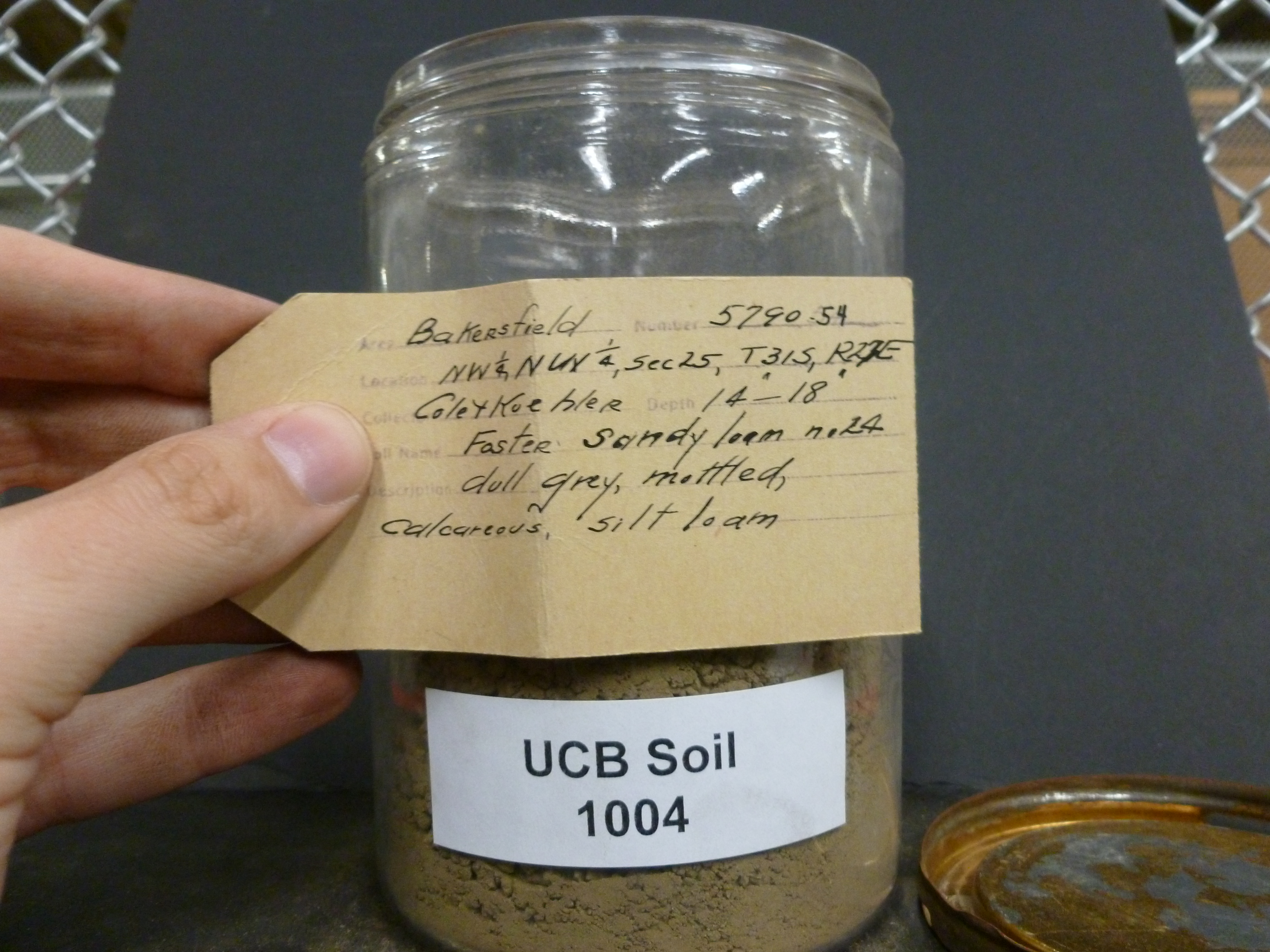 |
| Record ID | 1679
|
| UCB Soil | 1004 |
| Area | Bakersfield |
| Code | 5790-54 |
| Subsoil of | |
Verbatim
Location | NW 1/4, NW 1/4, Sec 25, T31S, R27E |
| Collector |
Cole & Koehler
| | Depth | 14.00 to 18.00 inches | | Soil Name | (24) Foster Sandy loam | Verbatim
Description | dull grey, mottled, calcareous, silt loam |
|
| Created By |
Taylor Winchell |
| Creation Date |
2013-02-25 15:17:42 |
| Updated By |
|
| | Coll. Date |
|
| City | |
| County |
|
| Meridian |
| | Township | 31 S | | Range | 27 E | | Section | NW 1/4, NW 1/4, Sec 25 | | Latitude | 35.206858 | | Longitude | -119.037295 | | Uncertainty Radius | 259 | | Georef by | skykorber | | Georef Remarks | |
| Code2 | |
Data Entry
Comments
(to flag the record) |
|
|
