click image to view enlargement
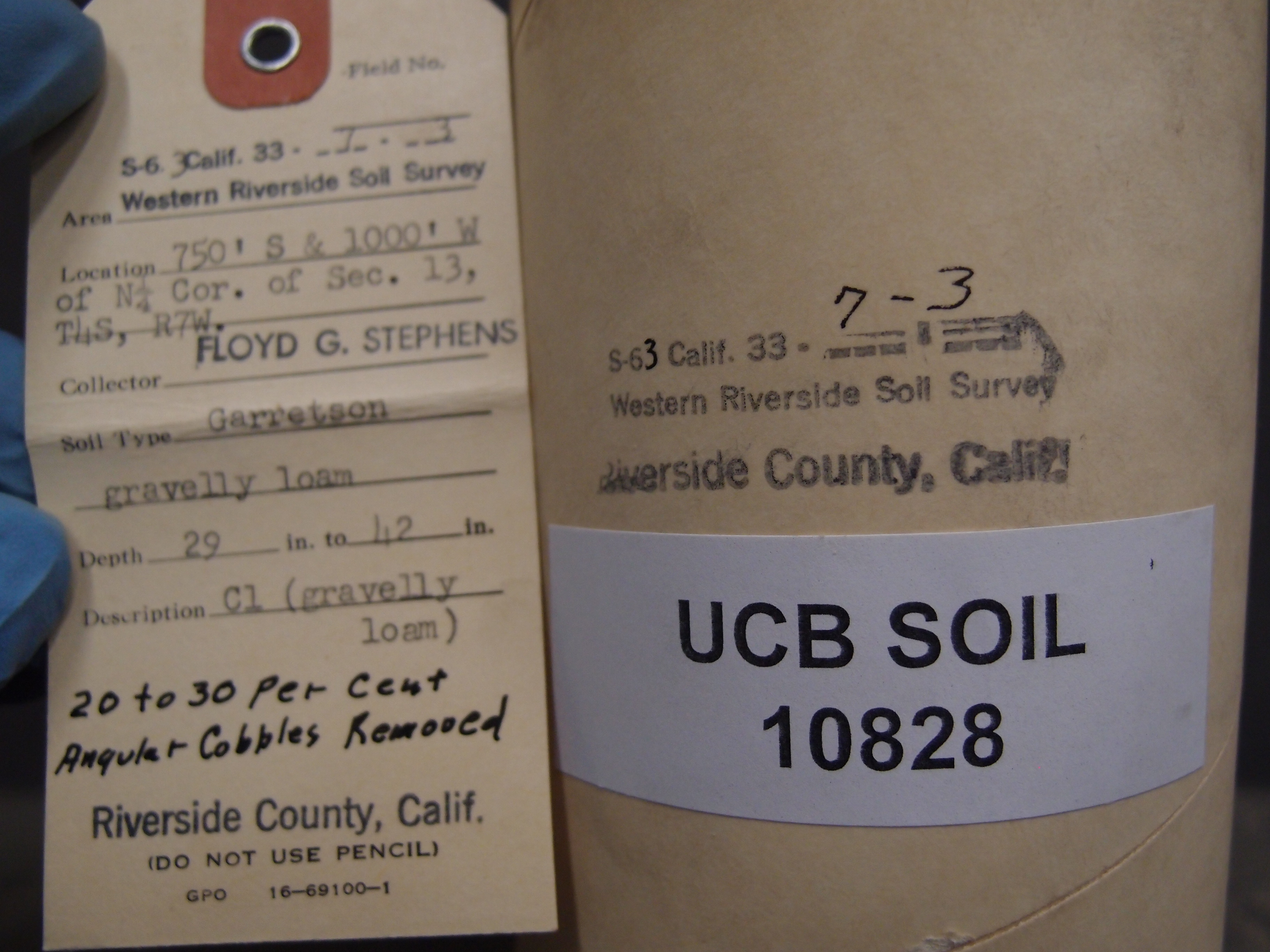 |
| Record ID | 11530
|
| UCB Soil | 10828 |
| Area | Western Riverside Soil Survey |
| Code | S-63 Calif 33-7-3 |
| Subsoil of | |
Verbatim
Location | 750' S & 1000' W of N1/4 Cor. of Sec. 13, T4S, R7W |
| Collector |
Floyd G Stephens
| | Depth | 29.00 to 42.00 inches | | Soil Name | Garretson Gravelly Loam | Verbatim
Description | C1 (gravelly loam) 20 to 20 percent angular cobbles removed. |
|
| Created By |
Natalie Mezaki |
| Creation Date |
2014-03-12 10:50:57 |
| Updated By |
|
| | Coll. Date |
|
| City | |
| County | Riverside County
|
| Meridian |
| | Township | 4 S | | Range | 7 W | | Section | N1/4 Cor. of Sec. 13 | | Latitude | 33.827312 | | Longitude | -117.574996 | | Uncertainty Radius | 406 | | Georef by | jrothery | | Georef Remarks | Boundaries of section 13 unclearly defined. Measured offset from assumed NW corner and expanded error to that point. |
| Code2 | C1 |
Data Entry
Comments
(to flag the record) |
|
|
