click image to view enlargement
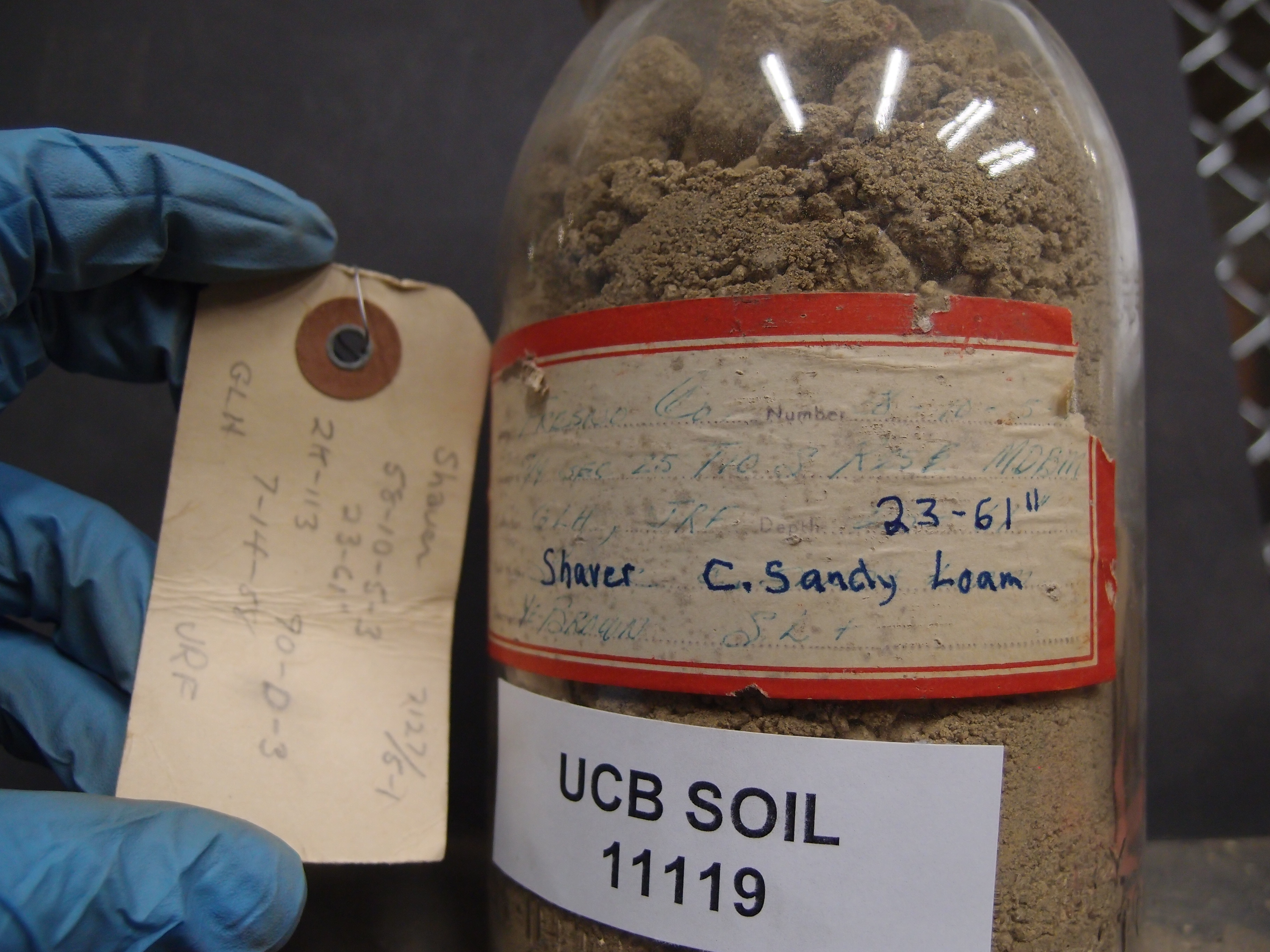 |
| Record ID | 8970
|
| UCB Soil | 11119 |
| Area | Fresno |
| Code | 58-10-5-3 |
| Subsoil of | |
Verbatim
Location | S/4 Sec 25 T10S R25E MDBM |
| Collector |
JR Fisher and GL Huntington
| | Depth | 23.00 to 61.00 inches | | Soil Name | Shaver C Sandy Loam | Verbatim
Description | 1/E Brown SL+ |
|
| Created By |
Natalie Mezaki |
| Creation Date |
2014-02-19 08:49:12 |
| Updated By |
|
| | Coll. Date |
1958-07-14 |
| City | |
| County | Fresno County
|
| Meridian |
| | Township | 10 S | | Range | 25 E | | Section | S/4 Sec 25 | | Latitude | 37.027774 | | Longitude | -119.195201 | | Uncertainty Radius | 969 | | Georef by | jrothery | | Georef Remarks | Error is extent of south half of section. |
| Code2 | 7127/5-1 90-0-3 2K-113 |
Data Entry
Comments
(to flag the record) |
|
|
