click image to view enlargement
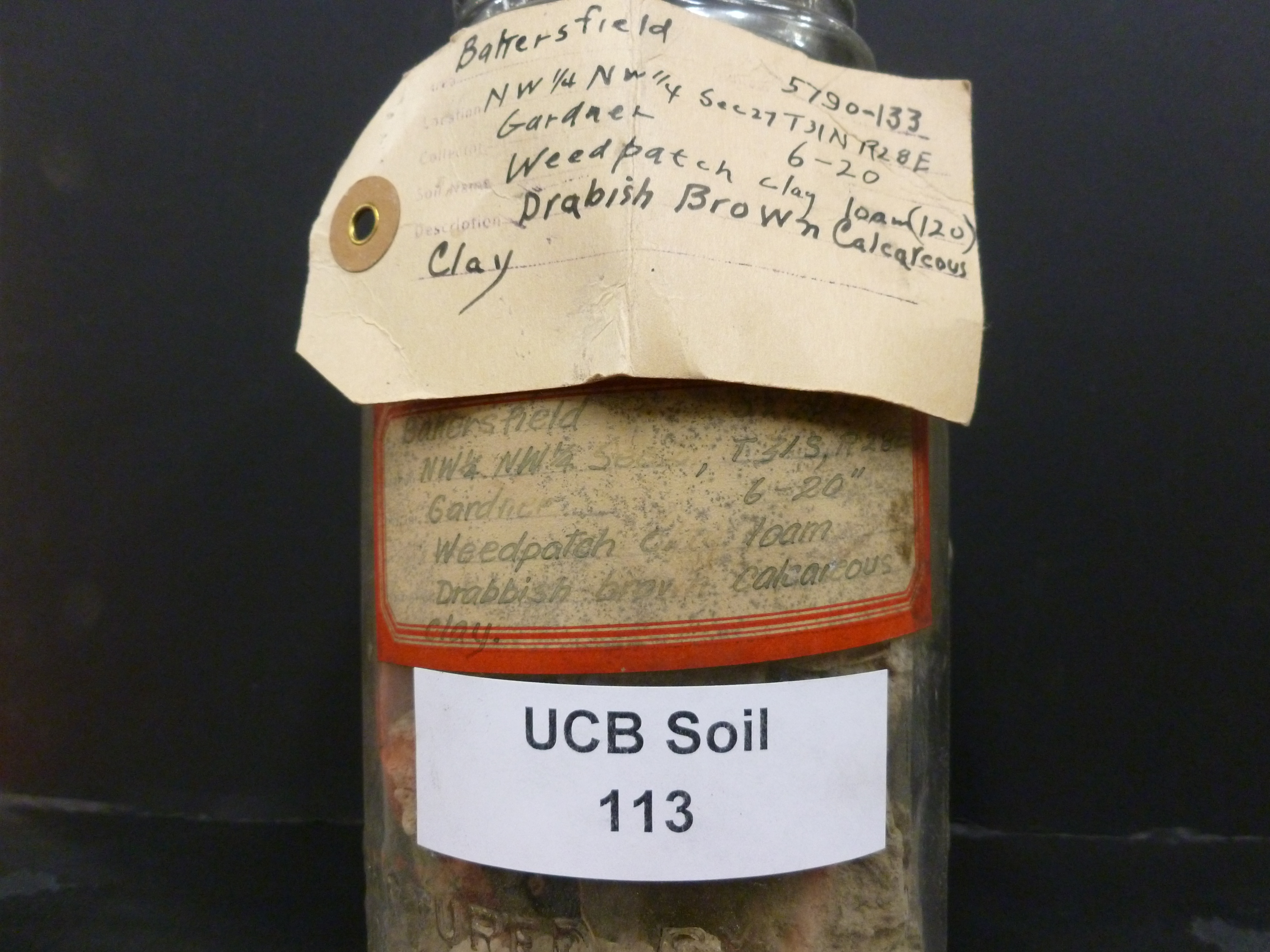 |
| Record ID | 120
|
| UCB Soil | 113 |
| Area | Bakersfield |
| Code | 5790-133 |
| Subsoil of | |
Verbatim
Location | NW 1/4 NW 1/4 Sec 27 T31N R28E |
| Collector |
RA Gardner
| | Depth | 6.00 to 20.00 inches | | Soil Name | (120) Weedpatch clay loam | Verbatim
Description | Drabish Brown Calcareous Clay |
|
| Created By |
Taylor Winchell |
| Creation Date |
2012-12-22 16:18:16 |
| Updated By |
Sky Korber |
| | Coll. Date |
|
| City | |
| County |
|
| Meridian |
| | Township | 31 N | | Range | 28 E | | Section | NW 1/4 NW 1/4 Sec 27 | | Latitude | 35.206459 | | Longitude | -118.952577 | | Uncertainty Radius | 285 | | Georef by | skykorber | | Georef Remarks | Used T31S for TRS |
| Code2 | |
Data Entry
Comments
(to flag the record) |
The interior label has "T31N" and the exterior label has "T31S". Label illegible; data entered on site, not from photo.
SK- Only T31S makes sense for the locality - SK |
|
