click image to view enlargement
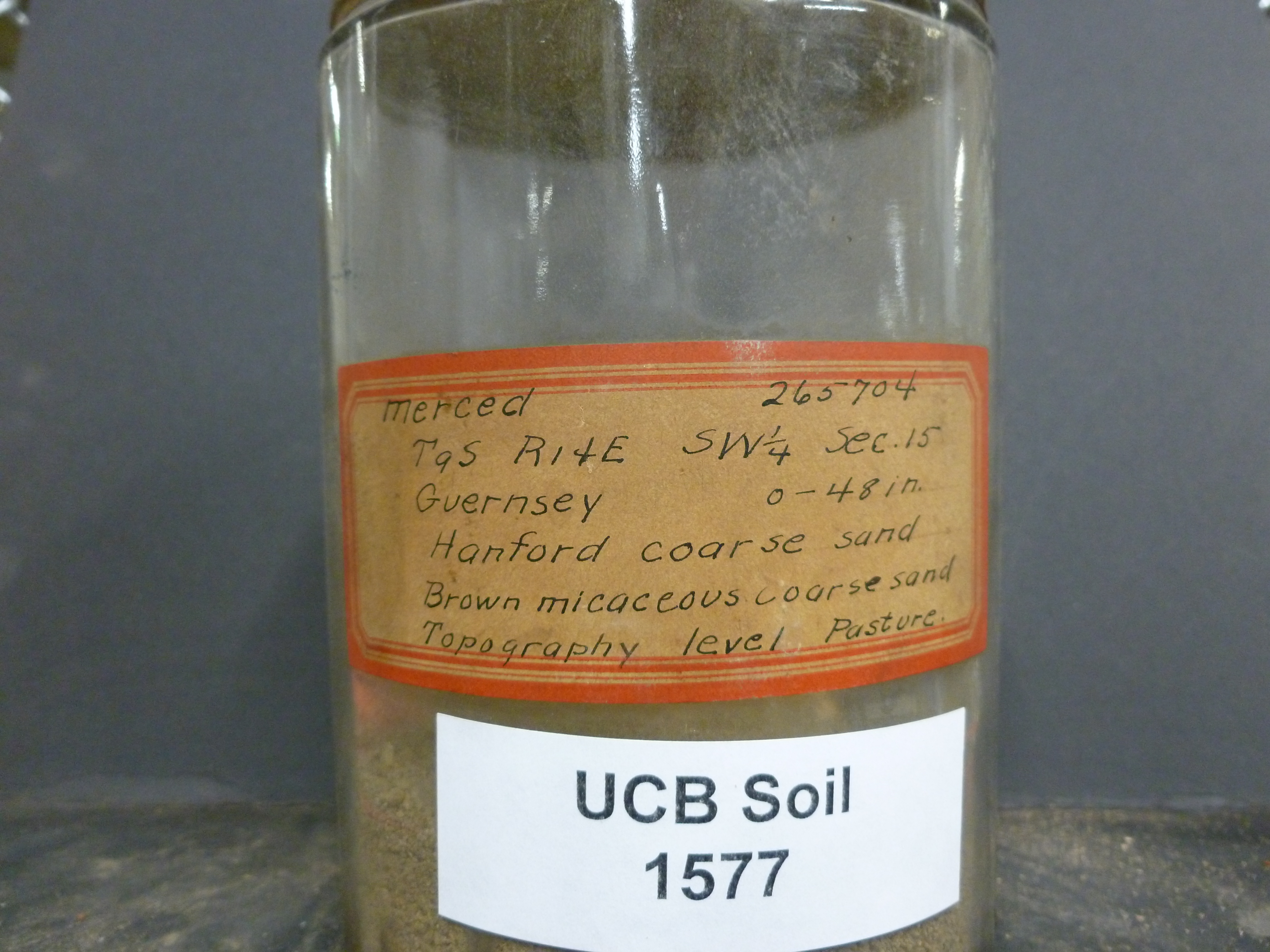 |
| Record ID | 6092
|
| UCB Soil | 1577 |
| Area | Merced |
| Code | 265704 |
| Subsoil of | |
Verbatim
Location | T9S R14E SW1/4 Sec 15 |
| Collector |
Guernsey
| | Depth | 0.00 to 48.00 inches | | Soil Name | Hanford coarse sand | Verbatim
Description | Brown micaceous coarse sand |
|
| Created By |
Tammy Dong |
| Creation Date |
2013-07-19 09:17:00 |
| Updated By |
Tammy Dong |
| | Coll. Date |
|
| City | |
| County |
|
| Meridian |
| | Township | 9 S | | Range | 14 E | | Section | SW1/4 Sec 15 | | Latitude | 37.145341 | | Longitude | -120.432634 | | Uncertainty Radius | 559 | | Georef by | jrothery | | Georef Remarks | Error is extent of described portion of section. |
| Code2 | |
Data Entry
Comments
(to flag the record) |
|
|
