click image to view enlargement
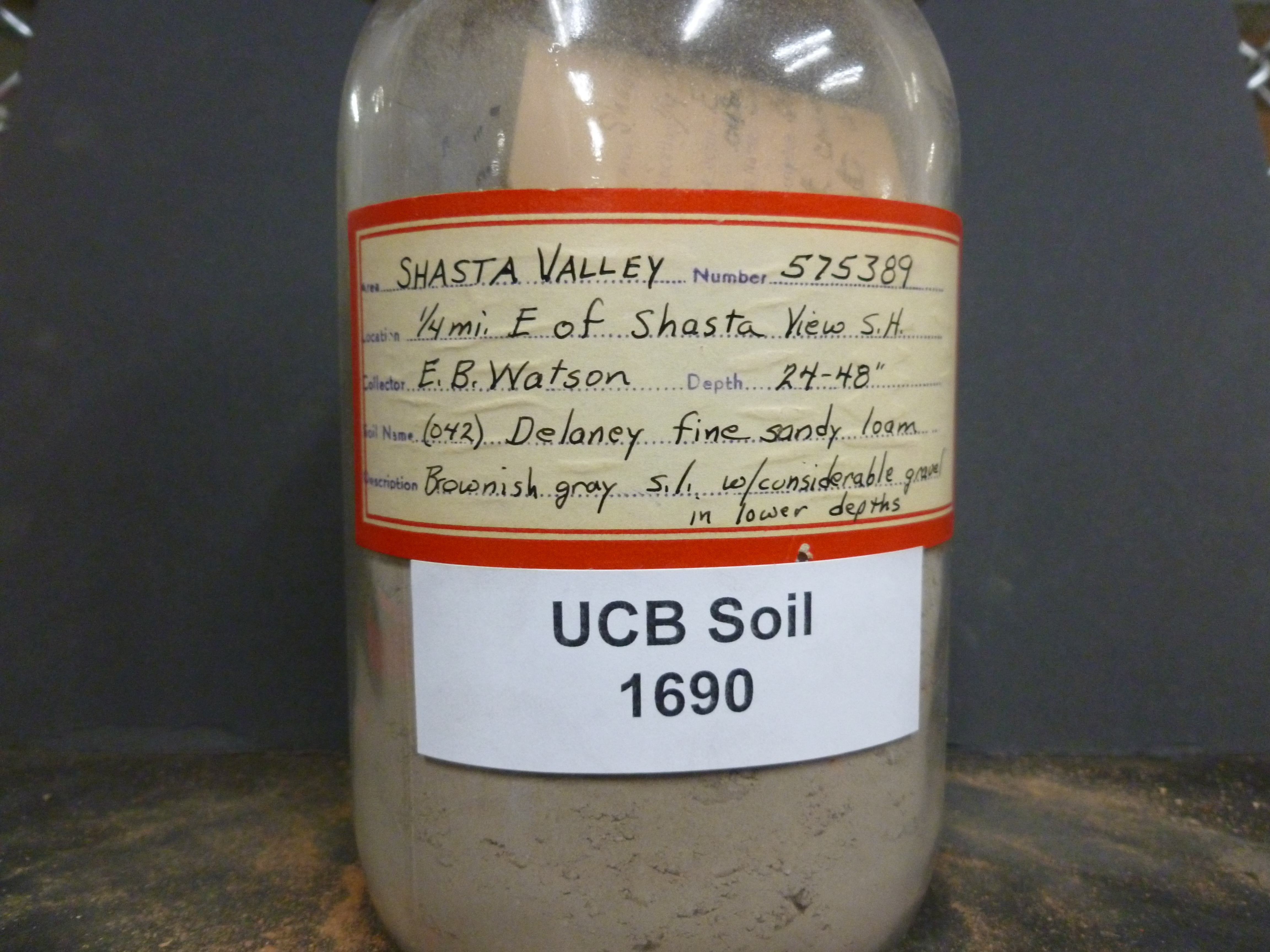 |
| Record ID | 6205
|
| UCB Soil | 1690 |
| Area | Shasta Valley |
| Code | 575389 |
| Subsoil of | |
Verbatim
Location | 1/4 mi E of Shasta View S.H. |
| Collector |
EB Watson
| | Depth | 24.00 to 48.00 inches | | Soil Name | (042) Delaney fine sandy loam | Verbatim
Description | Brownish gray s.l. w/ considerable gravel in lower depths |
|
| Created By |
Tammy Dong |
| Creation Date |
2013-07-19 12:19:09 |
| Updated By |
|
| | Coll. Date |
|
| City | |
| County |
|
| Meridian |
| | Township | | | Range | | | Section | | | Latitude | 41.597928 | | Longitude | -122.720085 | | Uncertainty Radius | 86667 | | Georef by | jrothery | | Georef Remarks | Unable to locate Shasta View SH. Error is extent of Shasta Valley Resource Conservation District. http://svrcd.org/wordpress/wp-content/uploads/2012/04/Siskiyou-County-Base-Map1.jpg |
| Code2 | |
Data Entry
Comments
(to flag the record) |
|
|
