click image to view enlargement
 |
| Record ID | 1164
|
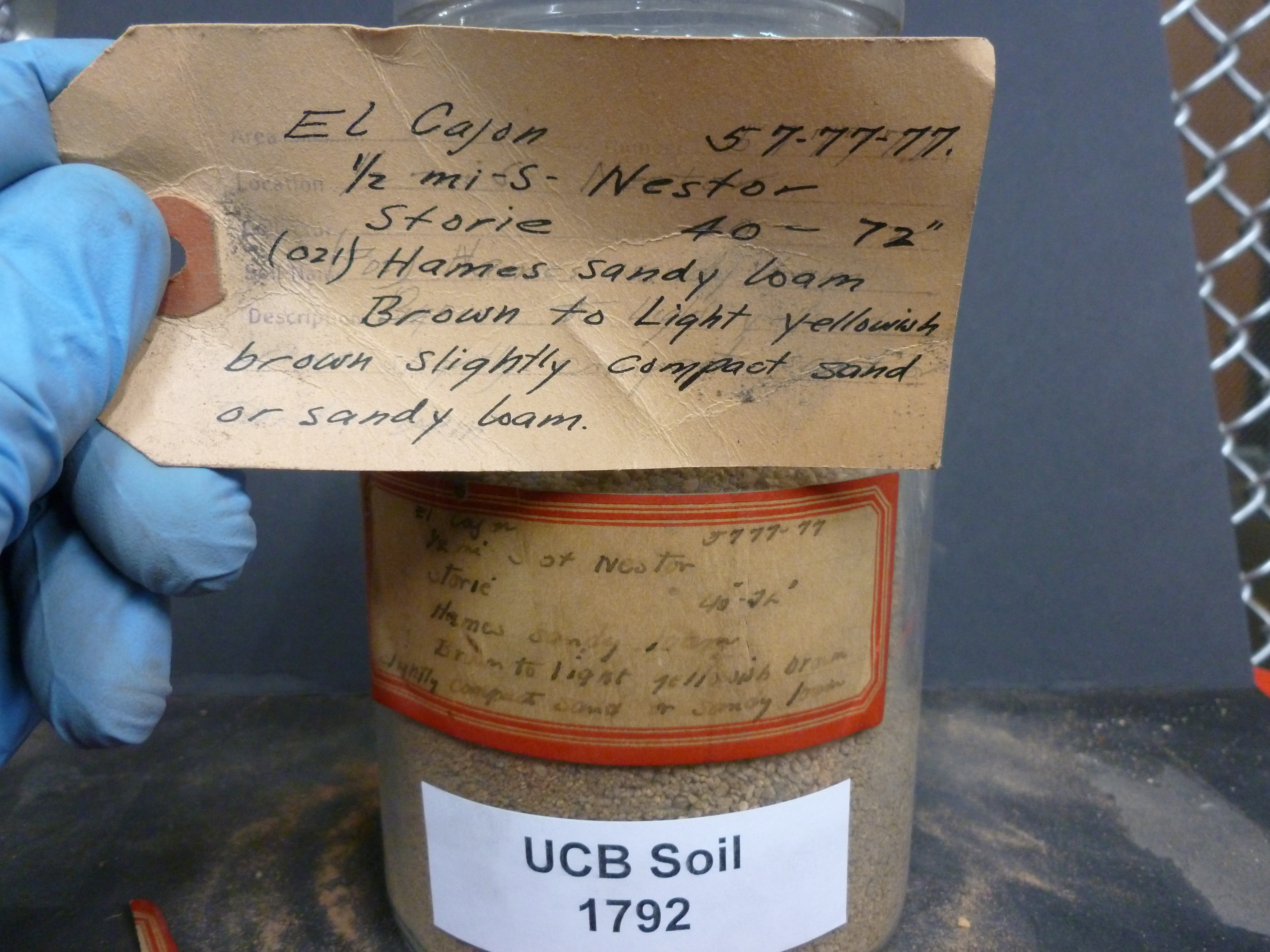
| UCB Soil | 1792 |
| Area | El Cajon |
| Code | 5777-77 |
| Subsoil of | |
Verbatim
Location | 1/2 mi S of Nestor |
| Collector |
RC Storie
| | Depth | 40.00 to 72.00 inches | | Soil Name | (021) Hames sandy loam | Verbatim
Description | Brown to light yellowish brown slightly compact sand or sandy loam |
|
| Created By |
Taylor Winchell |
| Creation Date |
2013-02-09 15:53:23 |
| Updated By |
|
| | Coll. Date |
|
| City | |
| County |
|
| Meridian |
| | Township | | | Range | | | Section | | | Latitude | 32.559539 | | Longitude | -117.086077 | | Uncertainty Radius | 761 | | Georef by | tammydong | | Georef Remarks | |
| Code2 | |
Data Entry
Comments
(to flag the record) |
|
|
