click image to view enlargement
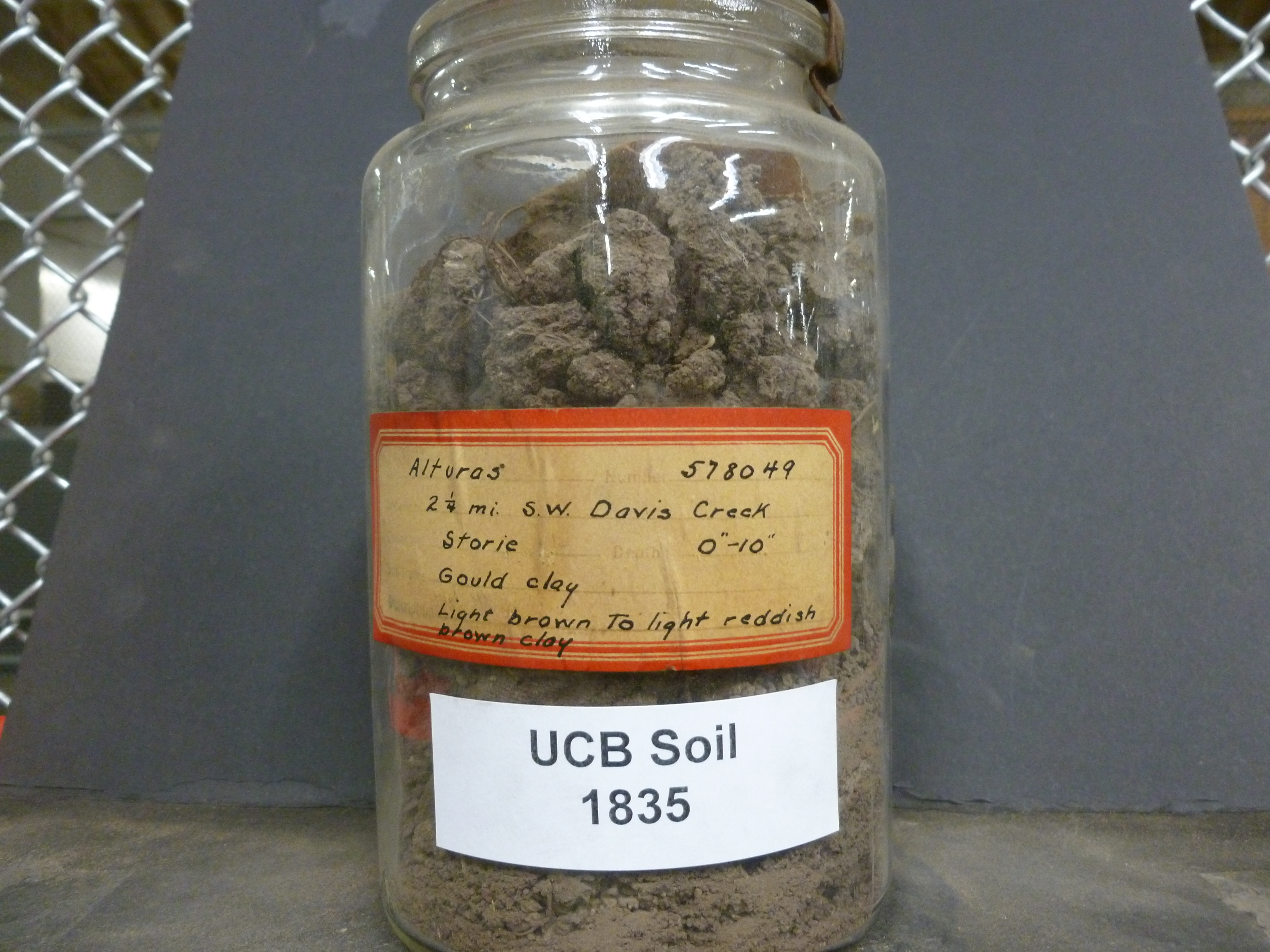 |
| Record ID | 1226
|
| UCB Soil | 1835 |
| Area | Alturas |
| Code | 578049 |
| Subsoil of | |
Verbatim
Location | 2 1/4 mi. S.W. Davis Creek |
| Collector |
RC Storie
| | Depth | 0.00 to 10.00 inches | | Soil Name | Gould clay | Verbatim
Description | Light brown to light reddish brown clay |
|
| Created By |
Taylor Winchell |
| Creation Date |
2013-02-11 19:32:00 |
| Updated By |
|
| | Coll. Date |
|
| City | |
| County |
|
| Meridian |
| | Township | | | Range | | | Section | | | Latitude | 41.712061 | | Longitude | -120.408939 | | Uncertainty Radius | 588 | | Georef by | tammydong | | Georef Remarks | Georeferenced from the town of Davis Creek |
| Code2 | |
Data Entry
Comments
(to flag the record) |
|
|
