click image to view enlargement
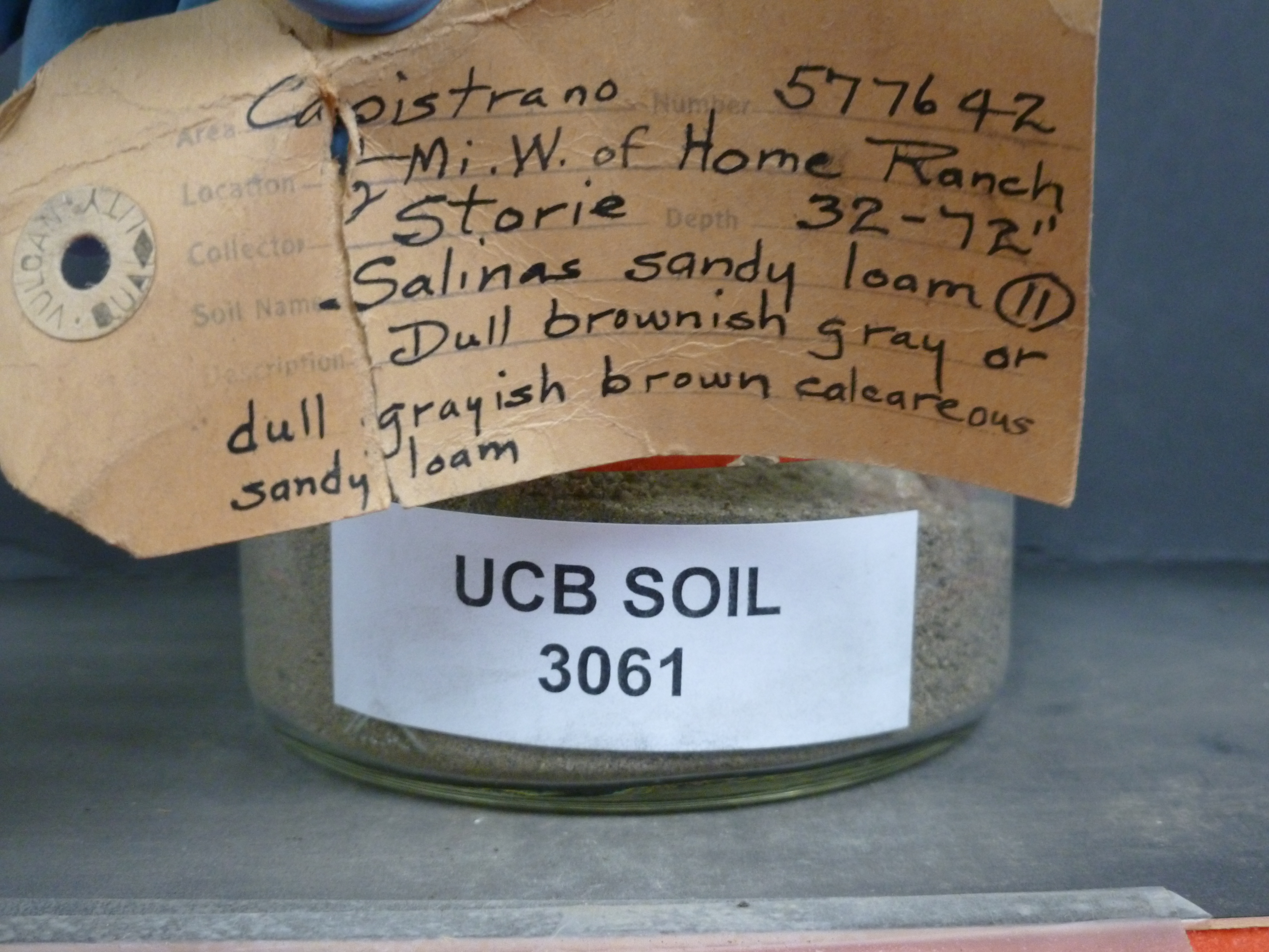 |
| Record ID | 5235
|
| UCB Soil | 3061 |
| Area | Capistrano |
| Code | 577642 |
| Subsoil of | |
Verbatim
Location | 1/2 mi W. Home Ranch |
| Collector |
RC Storie
| | Depth | 32.00 to 72.00 inches | | Soil Name | (11) Salinas sandy loam | Verbatim
Description | Dull brownish gray of dull grayish brown calcareous sandy loam |
|
| Created By |
Tammy Dong |
| Creation Date |
2013-07-03 11:15:33 |
| Updated By |
|
| | Coll. Date |
|
| City | |
| County |
|
| Meridian |
| | Township | | | Range | | | Section | | | Latitude | 33.310145 | | Longitude | -117.350879 | | Uncertainty Radius | 893 | | Georef by | nmezaki | | Georef Remarks | Selected Home Ranch closest to San Juan Capistrano that could be found. Marker is 1/2 mi W of Home Ranch and error extends back to ranch. |
| Code2 | |
Data Entry
Comments
(to flag the record) |
|
|
