click image to view enlargement
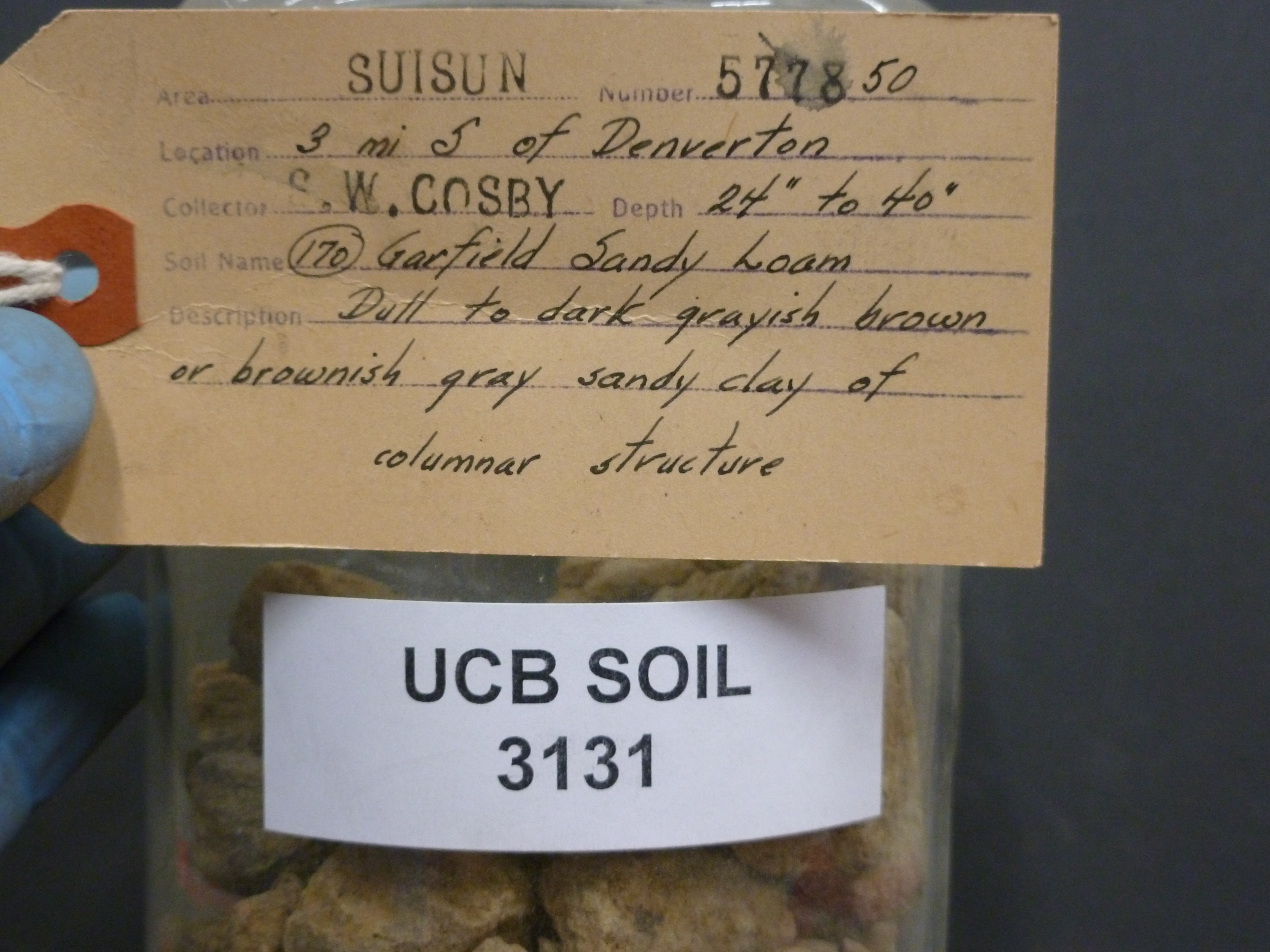 |
| Record ID | 5305
|
| UCB Soil | 3131 |
| Area | Suisun |
| Code | 577850 |
| Subsoil of | |
Verbatim
Location | 3 mi S of Denverton |
| Collector |
SW Cosby
| | Depth | 24.00 to 40.00 inches | | Soil Name | (170) Garfield Sandy Loam | Verbatim
Description | Dull to dark grayish brown or brownish gray sandy clay of columnar structure |
|
| Created By |
Tammy Dong |
| Creation Date |
2013-07-03 12:45:58 |
| Updated By |
|
| | Coll. Date |
|
| City | |
| County |
|
| Meridian |
| | Township | | | Range | | | Section | | | Latitude | 38.181225 | | Longitude | -121.896562 | | Uncertainty Radius | 4722 | | Georef by | rgottsegen | | Georef Remarks | Uncertainty extends to named place |
| Code2 | |
Data Entry
Comments
(to flag the record) |
|
|
