click image to view enlargement
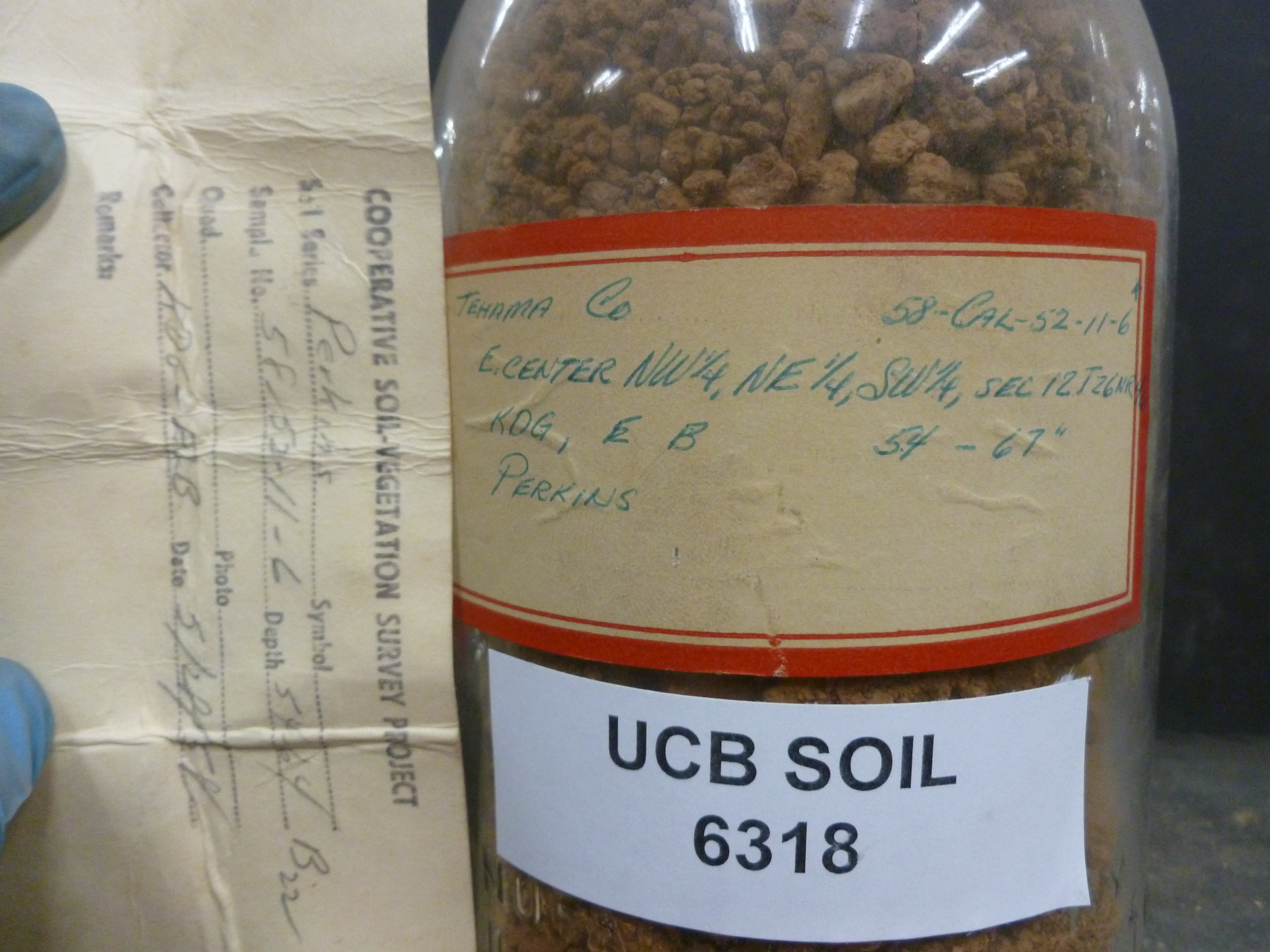 |
| Record ID | 13794
|
| UCB Soil | 6318 |
| Area | Tehama Co |
| Code | 58-Cal-52-11-6 |
| Subsoil of | |
Verbatim
Location | E.cent NW1/4, NE1/4, SW1/4, Sec12 T26N, R4W |
| Collector |
Eugene L Begg and Ken D Gowans
| | Depth | 54.00 to 67.00 inches | | Soil Name | Perkins | Verbatim
Description | |
|
| Created By |
Jessica Rothery |
| Creation Date |
2014-06-24 12:51:15 |
| Updated By |
|
| | Coll. Date |
1958-05-28 |
| City | |
| County |
|
| Meridian |
| | Township | 26 N | | Range | 4 W | | Section | E.cent NW1/4, NE1/4, SW1/4, Sec12 | | Latitude | 40.120385 | | Longitude | -122.271219 | | Uncertainty Radius | 185 | | Georef by | jrothery | | Georef Remarks | Error is extent of described portion of section. |
| Code2 | B22 |
Data Entry
Comments
(to flag the record) |
|
|
