click image to view enlargement
 |
| Record ID | 6420
|
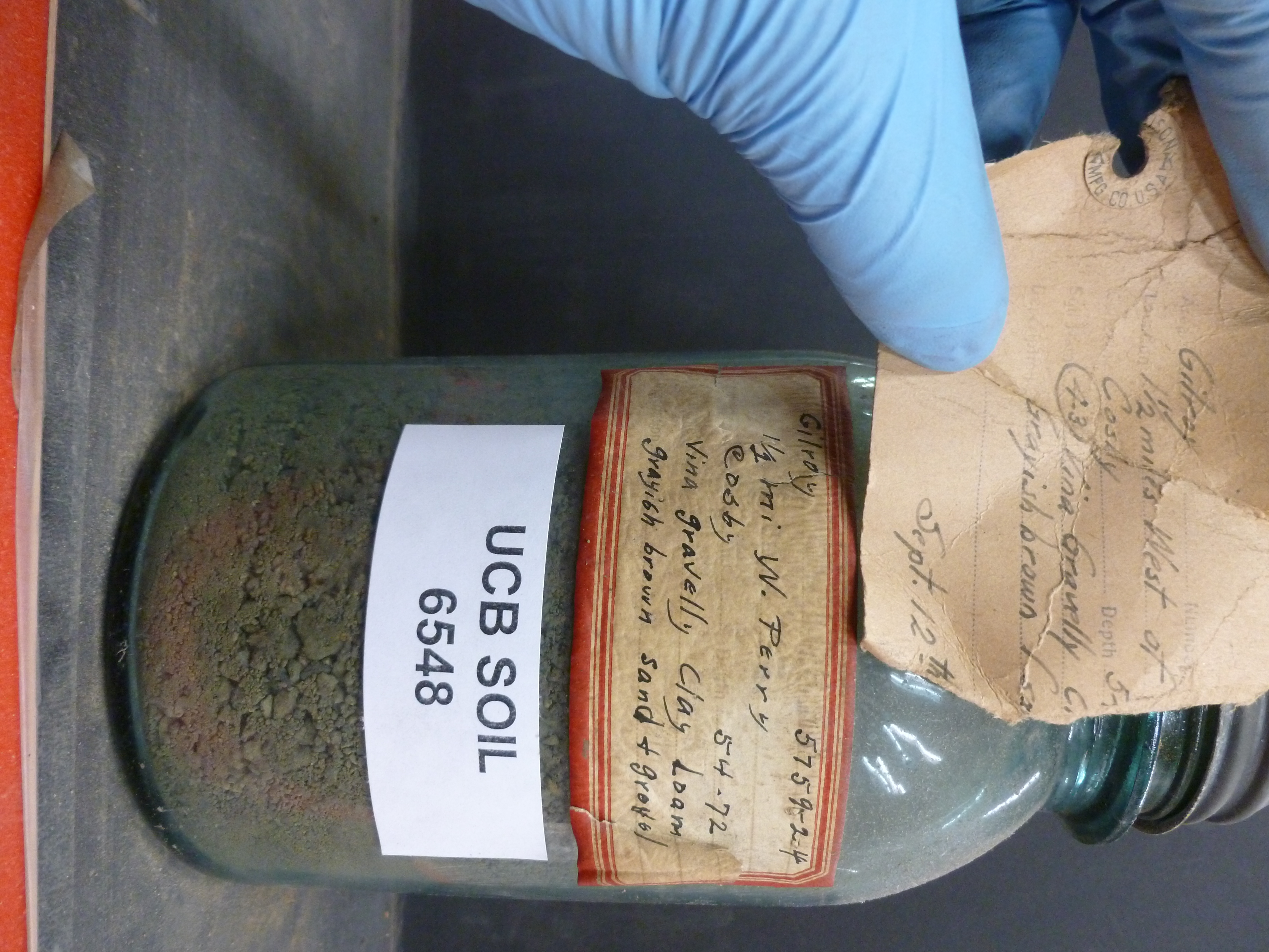
| UCB Soil | 6548 |
| Area | Gilroy |
| Code | 5759-24 |
| Subsoil of | |
Verbatim
Location | 1 1/2 mi W. Perry |
| Collector |
SW Cosby
| | Depth | 54.00 to 72.00 inches | | Soil Name | Vina gravelly Clay Loam | Verbatim
Description | grayish brown sand + gravel |
|
| Created By |
Preethi Kandhalu |
| Creation Date |
2013-10-14 09:49:36 |
| Updated By |
|
| | Coll. Date |
|
| City | |
| County |
|
| Meridian |
| | Township | | | Range | | | Section | | | Latitude | 37.183604 | | Longitude | -121.741682 | | Uncertainty Radius | 6203 | | Georef by | rgottsegen | | Georef Remarks | Marker is west of a small town named Perry in between San Jose/Santa Clara. Uncertainty measures halfway to the nearest named place (San Jose) |
| Code2 | 43 |
Data Entry
Comments
(to flag the record) |
|
|
