click image to view enlargement
 |
| Record ID | 6596
|
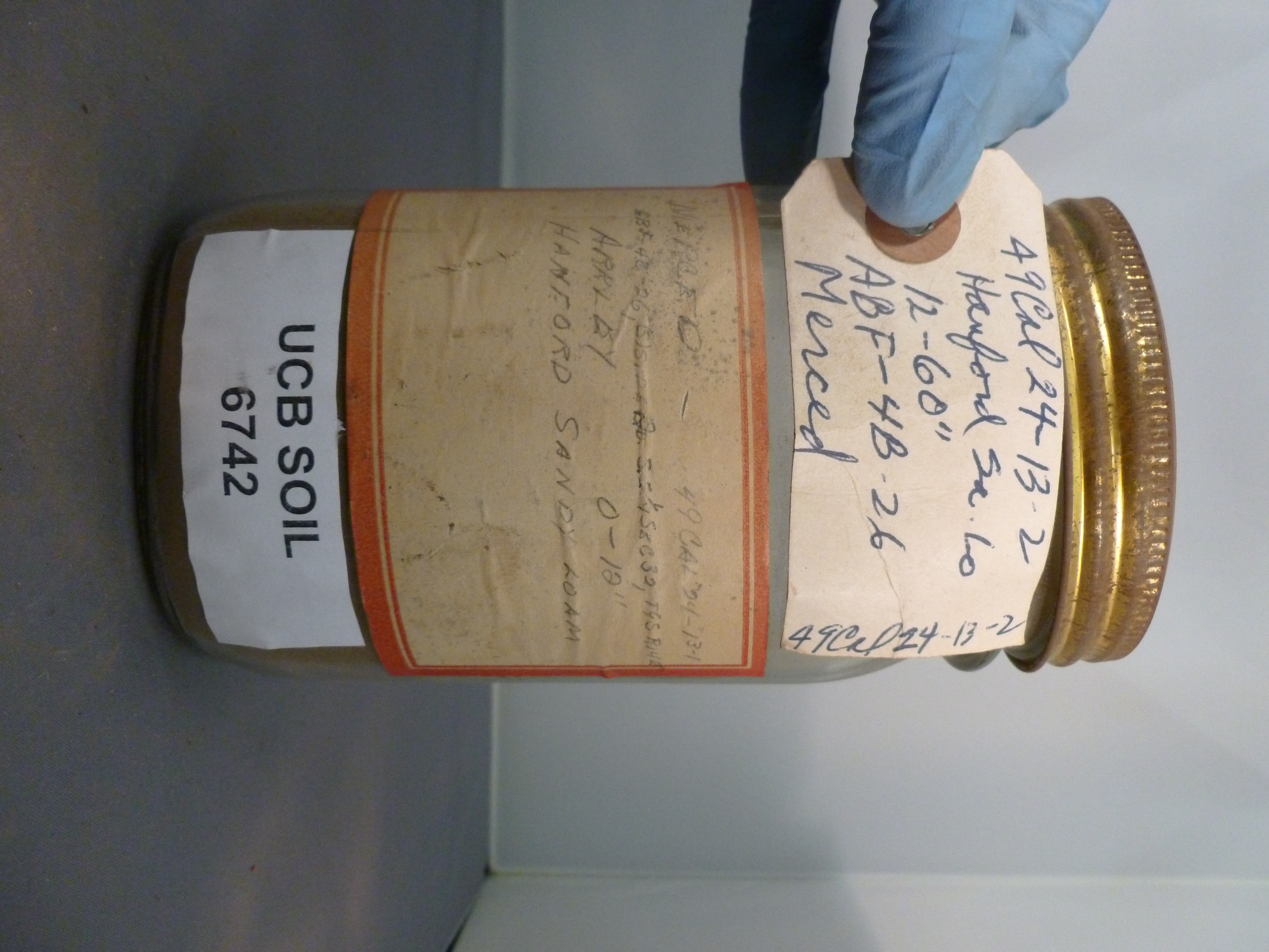
| UCB Soil | 6742 |
| Area | Merced |
| Code | 49 Cal 24-13-2 |
| Subsoil of | |
Verbatim
Location | SE 1/4 Sec 32 T9S R14E |
| Collector |
RJ Arkley
| | Depth | 0.00 to 12.00 inches | | Soil Name | Hanford Sandy Loam | Verbatim
Description | |
|
| Created By |
Sam Swayze |
| Creation Date |
2013-10-22 13:17:20 |
| Updated By |
Natalie Mezaki |
| | Coll. Date |
|
| City | |
| County | Merced County
|
| Meridian |
| | Township | 9 S | | Range | 14 E | | Section | SE 1/4 Sec 32 | | Latitude | 37.102416 | | Longitude | -120.459881 | | Uncertainty Radius | 505 | | Georef by | sswayze | | Georef Remarks | |
| Code2 | ABF-4B-26 |
Data Entry
Comments
(to flag the record) |
Depth on tags doesn't match; label says 0-10" and tag says 12-60" |
|
