click image to view enlargement
|
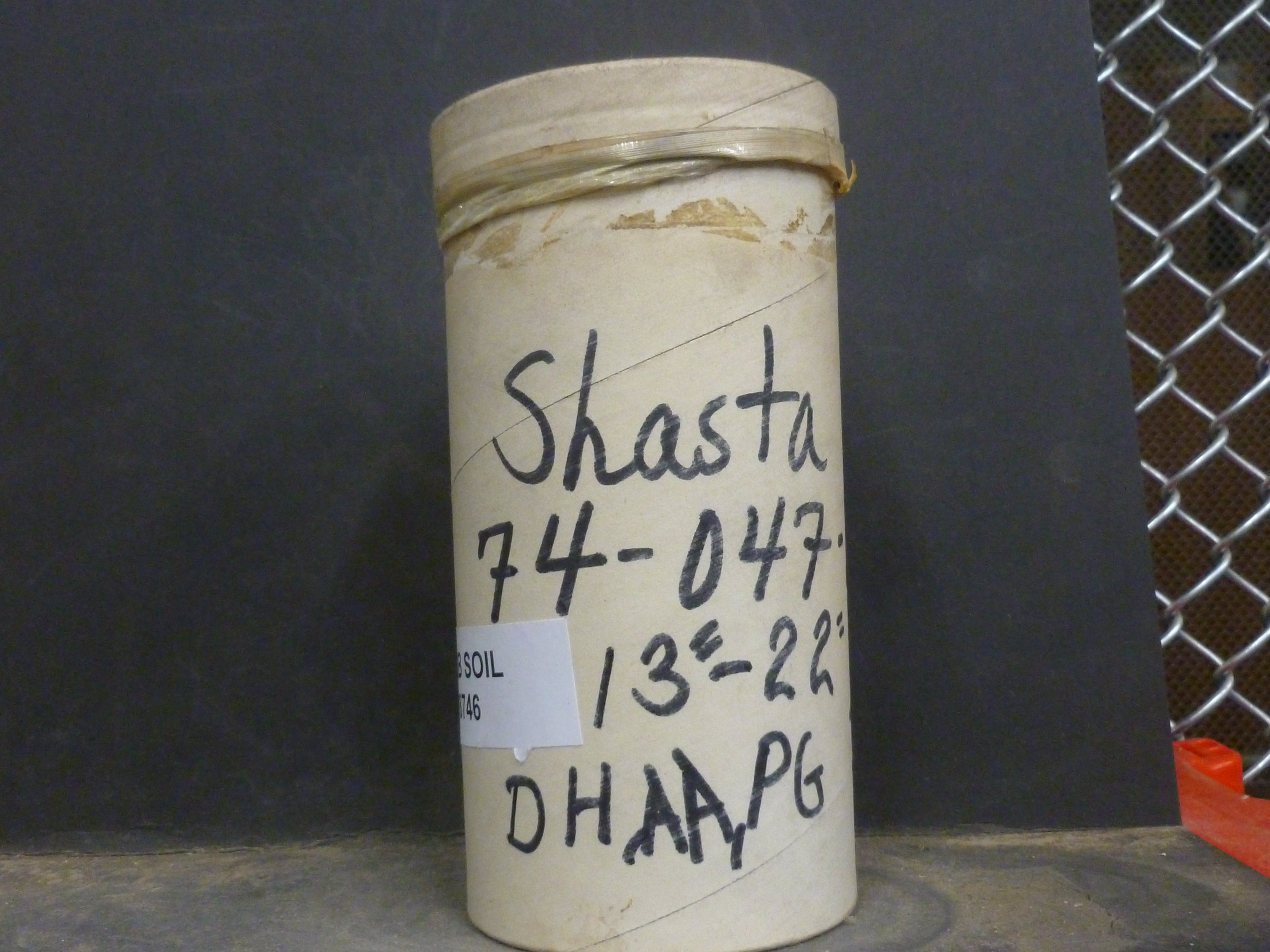
| Record ID | 8479
|
| UCB Soil | 8746 |
| Area | |
| Code | 74-047-104X-3 |
| Subsoil of | |
Verbatim
Location | |
| Collector |
AA, DH, and PG
| | Depth | 13.00 to 22.00 inches | | Soil Name | Shasta | Verbatim
Description | |
|
| Created By |
Natalie Mezaki |
| Creation Date |
2013-11-07 17:17:40 |
| Updated By |
|
| | Coll. Date |
1974-07-23 |
| City | |
| County |
|
| Meridian |
| | Township | | | Range | | | Section | | | Latitude | | | Longitude | | | Uncertainty Radius | | | Georef by | sswayze | | Georef Remarks | Only state level given |
| Code2 | 14A-4 9111 |
Data Entry
Comments
(to flag the record) |
|
|
