click image to view enlargement
 |
| Record ID | 10295
|
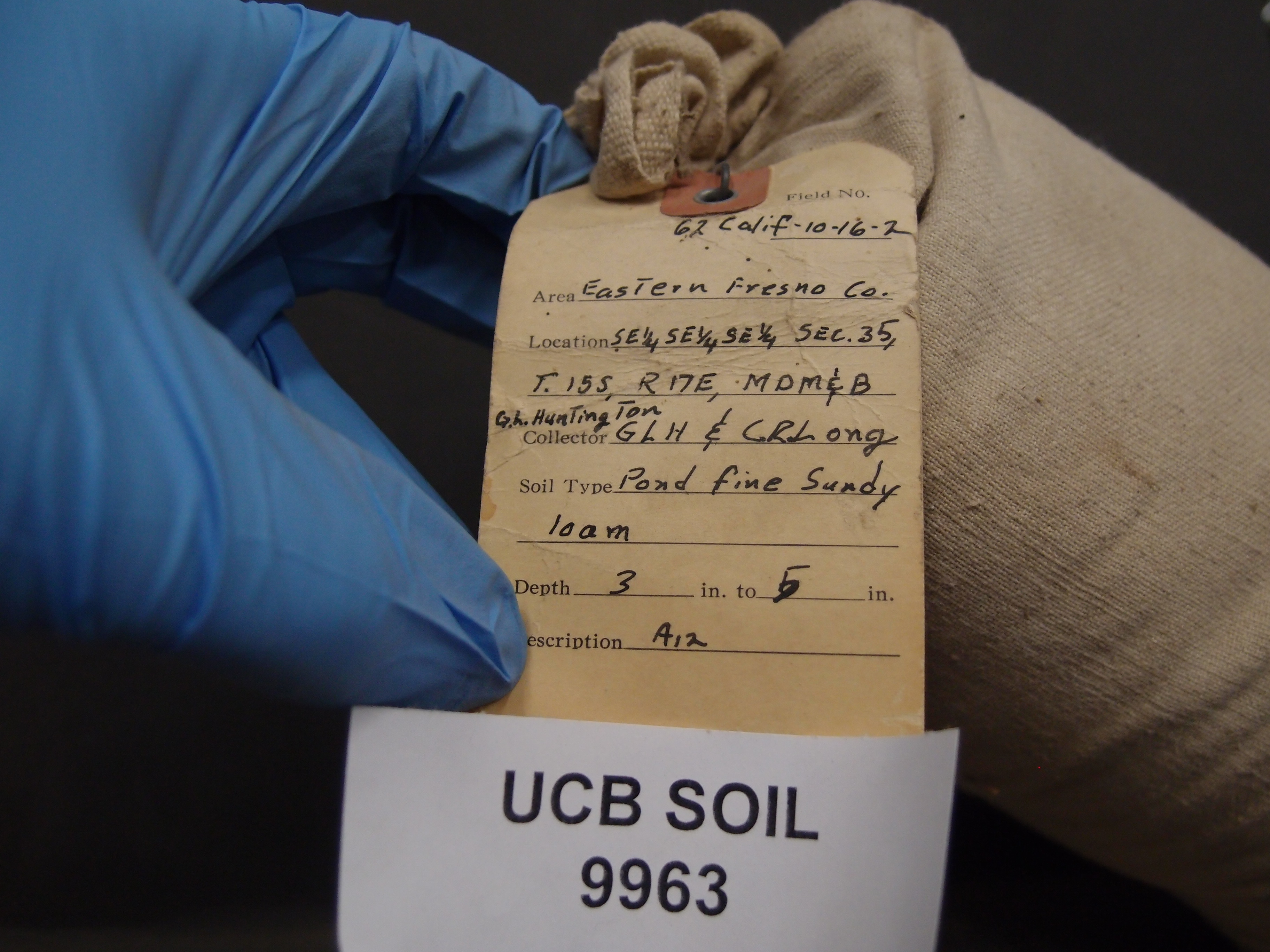
| UCB Soil | 9963 |
| Area | Eastern Fresno Co. |
| Code | 62 Calif 10-16-2 |
| Subsoil of | |
Verbatim
Location | SE 1/4 SE 1/4 SE 1/4 Sec 35 T15S R17E |
| Collector |
GL Huntington and C Long
| | Depth | 3.00 to 5.00 inches | | Soil Name | Pond fine sandy loam | Verbatim
Description | |
|
| Created By |
Sam Swayze |
| Creation Date |
2014-03-03 15:58:59 |
| Updated By |
Natalie Mezaki |
| | Coll. Date |
|
| City | |
| County | Fresno County
|
| Meridian |
| | Township | 15 S | | Range | 17 E | | Section | SE 1/4 SE 1/4 SE 1/4 Sec 35 | | Latitude | 36.574938 | | Longitude | -120.08027 | | Uncertainty Radius | 263 | | Georef by | rgottsegen | | Georef Remarks | uncertainty includes the SE 1/4 of the SE 1/4 of the SE 1/4 |
| Code2 | A12 |
Data Entry
Comments
(to flag the record) |
|
|
